Alsea Falls Loop
The Alsea Falls Loop Trail, located in Oregon’s Coast Range southwest of Philomath and west of Monroe, offers visitors a scenic hiking and mountain biking experience featuring beautiful waterfalls and lush forest landscapes. This trail system, managed by the Bureau of Land Management, has gained popularity for its diverse terrain and well-maintained paths suitable for various outdoor activities.
Trail Summary
Trailhead: Located at the Alsea Falls Recreation area about 45 minutes south of Corvallis.
Access: Stellar Jay/Hard Rock Trailhead, Alsea Falls/South Fork Mile Trailhead, Green Peak Falls Trailhead, and the 14-6-9 and 14-7-36 Trailhead.
Length: 9.6 miles.
Elevation Gain: 1,282 feet maximum, but depends on how much of the loop traversed.
Difficulty: Moderate for the main loop.
Landmarks: Alsea Falls, Greenpeak Falls.
Trail Difficulty and Suitable Skill Levels
The Alsea Falls Loop Trail system offers a range of difficulty levels suitable for various skill levels, from beginners to advanced hikers and mountain bikers. The main loop trail is generally considered moderately challenging, taking an average of 1 hour to complete for hikers. For mountain bikers, the difficulty ranges from beginner to advanced, with more challenging trails located at higher elevations. The trail to Alsea Falls and Green Peak Falls is rated as easy to moderate, making it family-friendly and accessible to most hikers. However, some sections of the trail feature steep inclines and stairs, which may pose challenges for less experienced hikers or those with mobility issues. The diverse terrain and well-maintained trails cater to a wide range of outdoor enthusiasts, allowing visitors to choose routes that match their abilities and preferences.
Nearby Landmarks and Attractions
The Alsea Falls Recreation Area offers more than just the loop trail, with several notable landmarks and attractions nearby. The centerpiece of the area is Alsea Falls itself, a 20-foot waterfall that can be easily accessed via a short trail from the campground or recreation area. Another highlight is Green Peak Falls, a more impressive 60-foot cascade located a short hike from Alsea Falls. These waterfalls are particularly spectacular during the spring when snowmelt and rainfall increase water flow.
The area is also known for its rich biodiversity. Visitors can observe various plant species, including fairyslipper, fawn lily, and trillium, which add splashes of color to the forest floor. Wildlife enthusiasts may spot American Dippers nesting near the waterfalls, as well as Winter Wrens and Chestnut-backed Chickadees in the surrounding forest. For those interested in extending their outdoor experience, the Alsea Falls Campground provides overnight accommodations, though it’s important to note that the campground and some facilities are seasonal, typically closed from mid-December to mid-May.
Sources:
Oregon Hikers, MTB Project, Trail Forks, All Trails, The Right Trail
Related Articles
Biking, Events, Outdoors, Sports & Wildlife

🏈 Ducks Football vs Oklahoma State – Saturday, September 6 at Autzen Stadium This Saturday, September 6, 2025, the No. 6 Oregon Ducks return to Autzen Stadium to host...
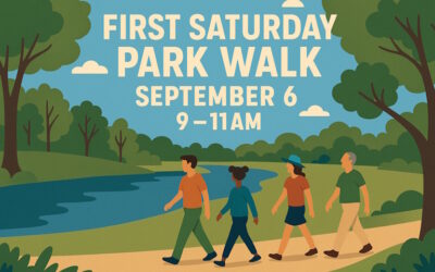
🚶♀️ First Saturday Park Walk: Rediscover Eugene One Step at a Time Eugene, OR – Saturday, September 6, 2025 | Downtown Riverfront Park Let’s be honest: how often do...

☀️ How to Make a Solar Oven Imagine whipping up s’mores, roasted veggies, or even a baked potato using nothing but sunshine. No propane tank, no power cord, no fire...

Backsplash Installation Eugene Oregon Snap—your kitchen just went from “meh” to “chef‑chic.” Backsplash Installation isn’t a minor upgrade—it’s a statement. It sweeps...

Ducks Football: Season Opener Against Montana State – August 30 Get ready, Duck fans—Autzen Stadium is almost about to erupt! The Oregon Ducks kick off the 2025...

🏜️ Adventure Awaits: Giant Buggy Sand Dune Tour for Youth in Lane County Eugene, OR – Tuesday, August 26, 2025 | Ages 12–15 Oregon’s coastline isn’t just beaches—it’s...

🍄 How to Forage Safely for Mushrooms in Lane County Forests (Plus Local Swap & ID Clubs) Picture this: you’re walking through a damp Douglas-fir forest, morning fog...
Artificial Grass Installation Eugene Oregon The moment you realize your yard could look like a green carpet all year (no mowing, no brown spots)—Artificial Grass...

🏐 Ducks Volleyball Heads to Corvallis for Exhibition Match vs Oregon State – August 23 The Oregon Ducks Women’s Volleyball team is gearing up for the 2025 season with...

Oregon Parkinsons Warriors Foundation: Where Movement Meets Community Knocking Out Parkinson’s Disease One Punch at a Time!Since founding in May 2023, the Oregon...

🏃♂️ Scandia Run 2025 – Junction City’s Longest-Running Road Race Every August, Junction City comes alive with the vibrant colors, music, and traditions of the...

⚽ Ducks Womens Soccer Kicks Off Season Against Weber State – August 14 at Papé Field The University of Oregon Women’s Soccer team is set to open their 2025 season with...

Fix-It Booths: Free Community Repair in Lane County Repair, Reuse, and Reconnect With Your Community If your toaster’s on the fritz, your favorite sweater has a tear,...

Your cracked windshield didn’t choose its moment—but Auto Glass Repair will rescue your ride and your peace of mind. Key takeaways: Repair often trumps...

🐝 How to Build a Mason Bee House (…and keep your tiny tenants happy, healthy, and rent‑free) Mason bees don’t make honey, don’t live in hives, and don’t want drama....

Groove Under the Sky: Satin Love Orchestra at Emerald Park Eugene, OR – Sunday, August 10, 2025 Remember that feeling of dancing like no one is watching, with the sun...

Basement Renovation Eugene Oregon Your basement in Eugene deserves to shed its gloom and become your home's most vibrant hangout. Basement Renovation isn’t just a...

🍇 How to Make Blackberry Jam (Without Losing Your Sanity or Half a Pint to Your Shirt) Oregon blackberries: delicious, invasive, and determined to take over your...

The Scandinavian Festival Returns to Junction City: Celebrate Heritage, Food & Folk Magic August 14–17, 2025 | Downtown Junction City, Oregon When you step into...

Architectural Drawings Eugene Oregon The moment you pick up your pen—or launch your CAD software—you step into the world of Architectural Drawings: where creativity...